Jakarta annual flooding in January 2013
This post was aimed to document the flood that inundated Jakarta in January 2013. Many parts of Jakarta were inundated following heavy rain on January 16, 2013. The floods killed at least 20 people and sent at least 33,502 fleeing their houses as reported by the National Disaster Mitigation Agency (BNPB) (The Jakarta Globe, January 22, 2013).
The floods also inundated the face of the capital of Indonesia - the Round of Hotel Indonesia and the Merdeka presidential palace. This was the first time that both areas were inundated by the annual Jakarta floods. These areas were not inundated in the previous floods. These areas were inundated because the dike of Ciliwung River under the flyover of Latuharhary collapsed.
 |
Source: The Facebook page of the Jakarta Globe, accessed on May 7, 2013
|
The Merdeka presidential palace was also inundated and President Susilo Bambang Yudhoyono delayed his state meeting with the Visiting Argentine President Cristina Fernandez de Kirchner due to the flooding. The below photo shows President Susilo Bambang Yudhoyono and the Secretary of State Marty Natalegawa inspected the inundated Merdeka Presidential Palace on January 16, 2013.
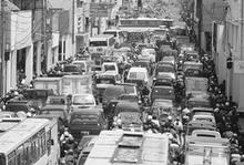
Following the floods, there were a number of proposals to prevent and mitigate the floods in Jakarta including the development of deep tunnel and the removal of illegal buildings in the watershed areas of Puncak in Bogor, West Java.
The proposal of deep tunnel was proposed by Governor Joko Widodo that can also be used to address the traffic congestion in Jakarta. The proposed tunnel was estimated to cost Rp 16 trillion and will run 22 kilometers at a depth of 40 meters. The tunnel will consist of three channels including two upper channels for traffic and the lowest one for channeling away rainwater runoff and carrying utility piping. The drainage channel will empty out into Jakarta Bay. Planned entry and exit points for vehicles will be located in the Gatot Subroto area to accommodate traffic coming from the Warung Buncit and Mampang areas, as well as Tomang and Slipi Jaya (The Jakarta Globe, March 18, 2013).
The proposal of demolishing illegal buildings in the watershed areas of Puncak was played down by the Minister of Forestry Zulkifli Hasan. Minister Hasan argued that there are about 40,000 households living there and it's not easy to evict them. He said it would take a lengthy process of discussions and awareness campaigns to get the residents to relocate. The Jakarta Globe reported that the initial zoning allowed for development in the Halimun-Salak area of Puncak was 40,000 hectares, but 130,000 hectares have now been paved over and developed, reducing the ground’s ability to absorb rainwater runoff and increasing the amount of water flowing downstream to Jakarta (The Jakarta Globe, March 6, 2013).
 |
| Source: The Facebook page of the Jakarta Globe, accessed on May 7, 2013 |


1 comment:
This is great. Thanks. I am currently writing a paper on urbanization and the fluvial process in Indonesia for URBP studies at SJSU. Hope to share soon.
Terima Kasih, Siddiq
Post a Comment